Problem Identification
A number of key principles were considered in the identification of problem areas and mitigation of flood risk:
- More stringent design criteria should be used to mitigate flooding for vulnerable areas;
- Solutions recognize that residents and property owners play an integral part in achieving the goals of this initiative, and
- Solutions cannot rely on only one level of intervention and need to include all components of the drainage system.
Level of Service is a benchmark used to determine where problem areas exist and determine where improvements are needed to mitigate the risks of flooding.
Level of Service
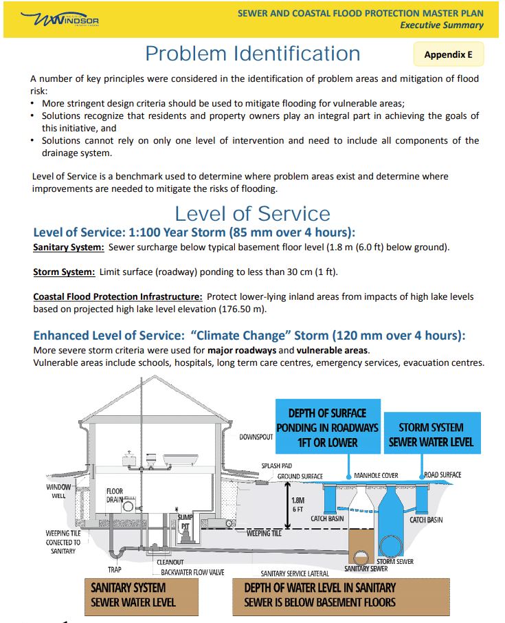
Level of Service: 1:100 Year Storm (85 mm over 4 hours):
Sanitary System: Sewer surcharge below typical basement floor level (1.8 m (6.0 ft) below ground).
Storm System: Limit surface (roadway) ponding to less than 30 cm (1 ft).
Coastal Flood Protection Infrastructure: Protect lower-lying inland areas from impacts of high lake levels based on projected high lake level elevation (176.50 m).
Enhanced Level of Service: "Climate Change" Storm (120 mm over 4 hours):
More severe storm criteria were used for major roadways and vulnerable areas. Vulnerable areas include schools, hospitals, long term care centres, emergency services, evacuation centres.
